Marangu Route

6 Days 5 Nights
  • 15
  • 80
  • English, French, Spanish, Kiswahili
  • Hotel before and after your hike, Huts on the mountain
  • All Mount Kilimanjaro National Park fees included
  • Dry seasons: January to mid-March and June to October
  • Fitness Level: Low to Moderate Why: Shortest route with hut accommodations and easier terrain but limited acclimatization time. Best For: Beginners or those preferring less rugged treks, with awareness of altitude challenges.
  • Breakfast, lunch, and dinner are freshly prepared daily. Designed to keep you full and provide the energy and nutrients needed for the climb.
  • Uhuru Peak: 5,895m (19,341 ft)

Marangu Route Mount Kilimanjaro Itinerary

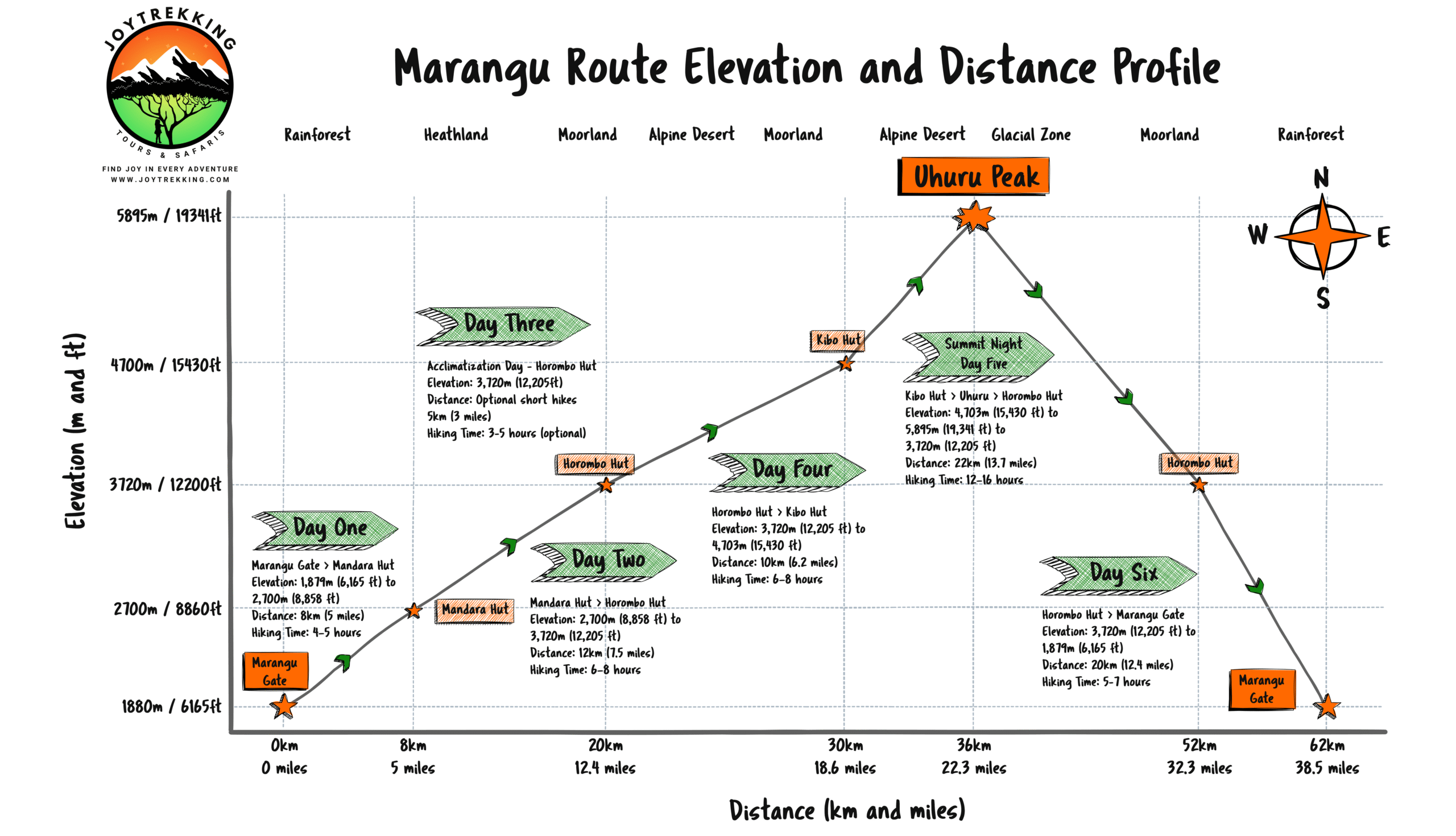
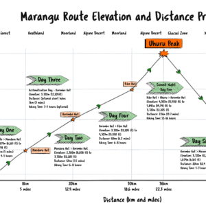
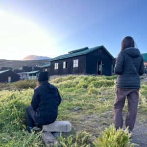
The Marangu Route, often called the “Coca-Cola Route,” is the only path with hut accommodations instead of tents, making it a popular choice for climbers seeking a slightly more comfortable experience. This 6-day trek follows a direct trail up Kilimanjaro’s southeastern flank, passing through dense rainforests, rolling moorlands, and high-altitude deserts. Known for its relatively moderate difficulty and iconic views of Mawenzi Peak, this route is ideal for beginners or those looking for a well-trodden path to Uhuru Peak.

Highlights

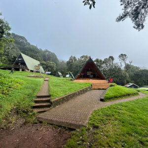
  • Hut Accommodations for a Comfortable Experience
  • Gradual Ascent for Beginners
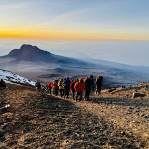
  • Stunning Views of Mawenzi Peak
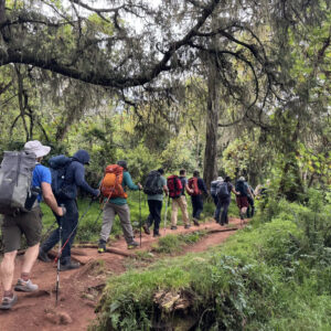
  • Diverse Flora and Fauna
  • Shortest Route to the Summit

Itinerary

  • Day
    One

    Arrival in Moshi

    Welcome to Moshi! Relax at your accommodation and prepare for the journey ahead. This day includes a pre-trek briefing, gear check, and an opportunity to meet your guides. Enjoy your first glimpse of Mount Kilimanjaro towering in the distance.

  • Day
    Two

    Marangu Gate to Mandara Hut

    Elevation: 1,870m (6,135 ft) to 2,720m (8,920 ft)
    Distance: ~8 km (5 miles)
    Hiking Time: 4–5 hours

    Start your adventure at Marangu Gate with a trek through the lush montane forest. The trail winds past towering eucalyptus trees and dense greenery, alive with birdsong and the occasional glimpse of colobus monkeys. You’ll reach Mandara Hut by late afternoon, located in a clearing on the forest edge.

    Tip: Keep your camera handy—this is the best section for spotting wildlife.

  • Day

    Three

    Mandara Hut to Horombo Hut

    Elevation: 2,720m (8,920 ft) to 3,720m (12,200 ft)
    Distance: ~12 km (7.5 miles)
    Hiking Time: 6–8 hours

    Leave the forest behind as you enter the heather and moorland zone. The trail offers sweeping views of the Mawenzi Peak and the surrounding valleys. The changing terrain includes giant heathers, volcanic rocks, and occasional patches of wildflowers. Horombo Hut provides a comfortable base with incredible views of both Kibo and Mawenzi.Highlight: Take a moment to enjoy the surreal beauty of the moorlands, with their unique plant life and wide-open landscapes.

  • Day
    Four

    Horombo Hut - Acclimatization Day

    Elevation: 3,720m (12,200 ft)
    Distance: Optional short hikes (~5 km/3 miles)
    Hiking Time: 3–5 hours (optional)

    Spend the day acclimatizing to the altitude. A popular acclimatization hike takes you to Zebra Rocks (3,980m/13,060 ft), named for their distinctive striped patterns. The extra time at Horombo Hut allows your body to adjust to the thinning air, improving your chances of a successful summit.Tip: Stay hydrated and rest when needed—acclimatization days are key to your success.

  • Day
    Five

    Horombo Hut to Kibo Hut

    Elevation: 3,720m (12,200 ft) to 4,703m (15,430 ft)
    Distance: ~10 km (6.2 miles)

    Hiking Time: 6–8 hours
    The trail gradually ascends through the high-altitude desert, a stark and barren landscape dotted with volcanic boulders. You’ll pass the “Last Water Point” before reaching Kibo Hut, situated at the base of the Kibo Crater. The air is thinner here, and the excitement builds for the summit attempt tomorrow.

    Highlight: The dramatic lunar landscape around Kibo Hut feels like stepping onto another planet.

  • Day
    Six

    Summit Day - Kibo Hut to Uhuru Peak to Horombo Hut

    Elevation: 4,703m (15,430 ft) to 5,895m (19,341 ft) to 3,720m (12,200 ft)
    Distance: ~22 km (13.7 miles)
    Hiking Time: 12–16 hours

    Your summit trek begins at midnight with a steep climb to Gilman’s Point (5,685m/18,650 ft) on the crater rim. From there, continue to Uhuru Peak, the highest point in Africa. Witness the sunrise over the glaciers and celebrate your incredible achievement. After a brief rest, descend to Kibo Hut for a quick stop before continuing to Horombo Hut for the night.

    Tip: Dress warmly, pace yourself, and remember—it’s all about determination on summit day.

  • Day
    Seven

    Horombo Hut to Marangu Gate

    Elevation: 3,720m (12,200 ft) to 1,870m (6,135 ft)
    Distance: ~20 km (12.4 miles)
    Hiking Time: 5–7 hours

    Descend through the moorland and lush rainforest back to Marangu Gate. Reflect on your journey as you soak in the vibrant sights and sounds of the forest. At the gate, you’ll collect your summit certificate and say goodbye to your trekking team. Return to Moshi for a well-earned celebration.

    Highlight: The descent offers a final opportunity to spot wildlife and savor the beauty of Kilimanjaro’s lower slopes.

Cost Includes

  • Transfer from hotel to mountain
  • Meals on the hike
  • Salaries for professional guides and porters
  • All park fees and taxes
  • Wifi at most camps

Cost Excludes

  • International flights, Airport taxes, Visa fee
  • Travel insurance
  • Lunch, dinner and beverages in the hotel
  • Snacks and energy bars, Items of a personal nature
  • Tips for the climbing crew
  • Personal gear rentals and purchases
  • Single supplement
  • Portable toilet and shower

FAQs for the Marangu Route

When is the best time to climb Mount Kilimanjaro on the Marangu Route?

The best time to climb the Marangu Route is in the dry seasons: January to mid-March and June to October. These months offer clearer skies and reduced rainfall, making the trail and hut accommodations more comfortable.

How long is the Marangu Route (in miles and average hours by day)?

The Marangu Route is about 37 miles (60 km) round trip, with daily hikes averaging 4–6 hours, except summit day, which takes 10–16 hours.

Is the Marangu Route crowded?

Yes, it’s one of the more popular routes, especially during peak climbing seasons.

What makes the Marangu Route unique?

It’s the only route with hut accommodations, making it a more comfortable option.

How challenging is the Barranco Wall?

The Barranco Wall is not part of the Marangu Route.

Is the Marangu Route suitable for beginners?

Yes, its shorter duration and hut accommodations make it beginner-friendly.

What’s the biggest highlight of the Marangu Route?

The convenience of staying in huts and the direct path to the summit.

Is the Marangu Route less crowded?

No, it’s one of the busiest routes due to its popularity.

What’s the wildlife like on the Marangu Route?

Wildlife is mainly spotted in the rainforest, with occasional monkey sightings.

How long is the Marangu Route?

The total distance is 37 miles (60 km).

What’s the biggest advantage of the Marangu Route?

Its shorter duration and hut accommodations provide comfort and accessibility.

Are there any acclimatization advantages on the Marangu Route?

It has fewer acclimatization opportunities due to its shorter duration.

What are the camping conditions on the Marangu Route?

No camping is required; trekkers stay in shared huts.

How long is the total trek on the Marangu Route?

The trek takes 5–6 days, including arrival and descent.

Is the Marangu Route suitable for climbers with limited time?

Yes, it’s the shortest route to the summit.

What are the main scenic highlights of the Marangu Route?

Mawenzi Peak and views from the summit.

Does the Marangu Route offer views of Mawenzi or Mount Meru?

Yes, Mawenzi Peak is visible during the ascent.

Is the Marangu Route busier during peak climbing months?

Yes, it’s highly popular during peak seasons.

Are there any technical or steep sections on the Marangu Route?

The final ascent to the summit is steep but non-technical.

What kind of flora and fauna can I expect on the Marangu Route?

Rainforests at lower elevations, with moorlands and alpine vegetation higher up

Does the Marangu Route pass through any villages or cultural landmarks?

No, it starts at Marangu Gate and leads directly up the mountain.

Are there any environmental risks or concerns on the Marangu Route?

Overcrowding during peak season can strain facilities.